

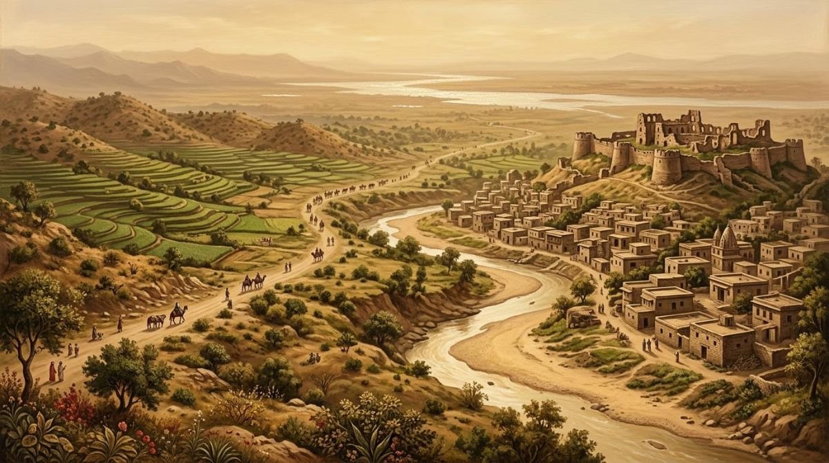
Chibhal (Urdu چھبال), “the land of the Chibs”, is the historic country of the Chib Rajputs: the hills, foothills and plains east of the Jhelum river and south of the Pir Panjal range, whose capital for some four centuries was Bhimber, in today’s Azad Jammu and Kashmir near the Pakistani Punjab border. After the death of Raja Shadab Khan (Baba Shadi Shaheed) in the sixteenth century it was divided along the Bhimber Nala into Chibhal Rajana in the east and Chibhal Rikki, or Raika, in the west, which included Khari Kariali.
At a glance
- Other names
- Mulk Chibhal (the state of Bhimber); Ilaqa Chibhal (the Chibhal tract)
- Named after
- The Chib clan, descendants of Raja Chib Chand
- Capital
- Bhimber, from the early 15th century to the last raja, Sultan Khan
- Old limits
- The Gujrat–Jhelum railway, the Jhelum, Khari Kariali, Kasgumah, Khui Ratta, the hills of Naushera and Manawar on the Tawi
- Eastern division
- Chibhal Rajana, the line of Raja Bhom Khan
- Western division
- Chibhal Rikki (Raika), with Khari Kariali, the line of Raja Mal Khan
- Today
- Mainly Bhimber District (Azad Kashmir) and Tehsil Kharian (Gujrat District, Punjab)
What is Chibhal?
The 1997 Chib history of Raja Muhammad Iftikhar Ali Khan says the hill country south of the Pir Panjal, in the Jammu province of the former Kashmir state, could fairly be called “a second Rajputana”, so many Rajput clans and families lived there. Among these hill tracts, it says, Chibhal was the one whose capital for centuries was Bhimber, and through Raja Chib Chand a clan of the Chib got grew up in it (p. 33). The name works on two levels: Chibhal is both the clan, as in “the Chibhal of the Samwalia got”, and its country. The book distinguishes Chibhal, the people, from Mulk Chibhal, their state of Bhimber, and calls the two the great legacies of Baba Shadi Shaheed (p. 17).
H. A. Rose’s Glossary (1911), translated in the book, explains the place-name from the clan: the Chibs live in the lower hills of Jammu and in northern Gujrat district, and the hilly part of Kashmir on the left bank of the Jhelum took the name Ilaqa Chibhal after them (pp. 25–26). For the clan as a whole, see our guide to the Chib Rajputs.
The boundaries of Chibhal
The book traces the limits of Ilaqa Chibhal “according to the ancient division” (p. 33):
- Start from the railway line between Gujrat and Jhelum, which formed the southern edge.
- Follow the eastern bank of the Jhelum river.
- Join the dry foothill strip (kandi) of Khari Kariali to Kasgumah, and continue above it to Khui Ratta.
- Pass south of the Lohi Dhakki of Naushera.
- Follow the dry (Sukki) Tawi south to Manawar.
- From Manawar return, in a slightly crooked line, to Gujrat.
Other passages describe the state at different moments of its history:
| Account | North | East | South | West |
|---|---|---|---|---|
| The state of Bhimber when Chib Chand arrived (Tarikh-e-Chibhal; Raja Wilayat Khan, pp. 30, 67) | Borders of Rajouri and Poonch | Chenab river | Gujrat and Kharian | Jhelum river |
| In Raja Shadi Chand’s time (Pothi family history, p. 166) | Kotli and Naushera | Manawar and the Tawi | Outskirts of Jhelum and Gujrat towns | Mangla and Mirpur |
| Ilaqa Chibhal by the old division (p. 33) | Khui Ratta and the hills of Naushera | Sukki Tawi to Manawar | Gujrat–Jhelum railway | Jhelum river |
A land of ruins and legends
The book paints Chibhal as a country of contrasts: green valleys and swaying fields on one side, handsome mountains and the scorching dry foothills on the other. It is full of monuments, temples and ruins. Tradition holds that the Pandavas of the Mahabharata lived in its hill valleys, and in Chibhal Rikki stood Pani Koti, the city remembered as the capital of Raja Porpal, or Porus, who faced Alexander the Great in this same country. Porus’s grandson through his daughter (his name is uncertain in the print) and a Raja Malik Pal are said to have ruled these hills for centuries afterwards, and the land saw, in the book’s words, great revolutions, bloodshed and ruin followed by resettlement (pp. 33–34).
Near Bhimber the book points to remains it assigns to the earliest Hindu period: in the Samahni valley, two temples of massive black stone on great platforms between Samahni and Bandala, which local people attribute to giants and fairies, and nearby the traces of an old tank known as the Pariyon ka Talla, the Fairies’ Pond (p. 38).
Bhimber, the capital
Bhimber was the capital of Mulk Chibhal and, the book says, the centre of the Chib clan for about four centuries, from Raja Chib Chand’s accession in the first quarter of the fifteenth century down to Raja Sultan Khan, the last ruler, and the arrival of British power and the 1846 settlement between the British and Raja Gulab Singh of Jammu (pp. 25, 36). According to the book, the seventeenth-century French traveller François Bernier called it Bab-ul-Kashmir, the Gate of Kashmir. G. M. D. Sufi’s Kashmir, citing the Kashmir archaeology report, describes it as a small town on the right bank of a stream of the same name that joins the Chenab near Wazirabad, 29 miles north of Gujrat, 23 miles east of Jhelum and 50 miles north-west of Sialkot, and 150 miles from Srinagar by the Pir Panjal route; here the plains end on the road to Kashmir (p. 37).
The town is old: the book holds that it already existed, under the same name, when the Chinese pilgrim Hiuen Tsang (Xuanzang) travelled in the region some thirteen centuries ago. For centuries the routes from the Punjab to Kashmir ran through it, and after the conquest of Kashmir in 1586 the emperor Akbar chose this route for the royal road linking Lahore and Kashmir (pp. 37–38). More on its role as a gateway is in Bhimber, Gateway to Kashmir.
How Chibhal was divided
The decisive event in Chibhal’s history, the book says, came after the death of Raja Shadab Khan, revered as Baba Shadi Shaheed. His brother Raja Dom Khan disputed the throne with the late raja’s sons, Raja Bhom Khan and Raja Mal Khan. The quarrel dragged on until news of it reached the emperor at Delhi, under whose overlordship Bhimber was then a semi-independent state. To spare the family bloodshed, the emperor sent a trusted official to settle the matter. Dom Khan withdrew into the mountains towards Poonch, where his descendants became the Domal; the elder son, Bhom Khan, was confirmed as raja of Bhimber; and the younger, Mal Khan, received the land west of the Bhimber Nala, including the plain of Kariali, as a small state named Khari Kariali (pp. 37–38).
A family history of the Rajgan of Pothi, Kasgumah and Lehri, printed later in the book, tells it more simply: after Raja Shadab Khan’s martyrdom the state was divided in equal shares between his two sons. Khari Kariali, with its headquarters at Mangla, went to Raja Mal Khan, and Chibhal Rajana, with its capital at Bhimber, to Raja Bhom Khan. The heads of the two houses ruled under the Mughal emperors, and in the weak reign of Muhammad Shah “Rangila” (1719–48) both states became independent and greatly enlarged their territory (p. 167). The story of the western state is told in Khari Kariali: The Second Chib State.
Chibhal Rajana and Chibhal Rikki
The division gave Chibhal its two historic halves, and the names still mark the map and the revenue records (pp. 33, 38).
| Chibhal Rajana | Chibhal Rikki (Raika) | |
|---|---|---|
| Extent | From the Naushera royal road to Bhimber, and from the east bank of the Bhimber Nala to Lala Musa | From the west of the Bhimber Nala to the Jhelum, including the plain of Khari Kariali |
| Line | Raja Bhom Khan, eldest son of Raja Shadab Khan, and the rajas of Bhimber | Raja Mal Khan, youngest son of Raja Shadab Khan, and the rulers of Khari Kariali |
| Seat in Bhimber | Bhimber Rajdhani or Rajani, on the east side, with Bhom Khan’s palaces and hall of public audience | Bhimber Rikki or Raiki, the site of Mal Khan’s palaces |
| In revenue records | The name Bhimber Rajdhani survives | The present town is still recorded as Bhimber Rikki |
The names carry the history. In Chibhal, the book explains, a ruler’s eldest son bore the title Raja and a younger son the title Rai. The quarter where Raja Mal Khan built his palaces therefore became Rai-ki Bhimber, “Bhimber of the Rai”, shortened to Bhimber Raiki or Rikki, while the eastern quarter, as the seat of government, was Bhimber Rajdhani or Rajani. The ruins of Bhom Khan’s palaces and Diwan-e-Am still stand, and both names survive in the papers of the Revenue Department (p. 38).
Sources differ
Thakur Major Singh’s Tarikh-e-Chibhal, quoted in the book, explains the names differently (p. 43). The land west of the Bhimber Nala that went to Mal Khan, he writes, was Khari Kariali, settled by two men of the Dutt clan: Kharak Chand founded Khari and Karam Chand founded Kariala, and the two names were joined. The present town of Bhimber lies within it. Raja Bhom Chand (Bhom Khan) built his palaces east of the stream, while a few households of ordinary subjects (ra’aya) lived on the site of the present town; so eastern Bhimber was Rajani, “of the rajas”, and western Bhimber Rikki, “of the subjects”. Major Singh calls the brothers’ father Raja Dharam Chand, which the book’s genealogical chart gives as the Hindu name of Raja Shadab Khan (pp. 42, 388). The Pothi family history differs again in placing Mal Khan’s headquarters at Mangla rather than Bhimber (p. 167).
Major Singh adds that every Muslim raja from Bhom Khan to Raja Sultan Khan lived in the eastern quarter; by his day only ruins and a single mosque were left of its splendour (p. 43). The rulers of the eastern line are listed in The Rajas of Bhimber.
Mandis, garhs and dheris
Within each division, land and authority were shared among the princes. Rose’s Glossary describes a jagir system whose traces, he says, still shaped Chib society: the throne of Bhimber belonged to the raja’s eldest son, but younger sons held authority in parts of the state (pp. 26–27).
- Four mandis: Malot, Bandala, Ghawaliyan and Rajal, large jagirs held by princes of the royal house while the eldest prince ruled as raja. The throne itself stayed in the line of Raja Ghanni Khan, the Ghanial.
- Four garhs (strongholds): Deva, Batala, names that recall Dewa Vatala, home of the Hindu Chibs, and two others whose names are uncertain in the print. They belonged to the Ghaghial, descendants of Raja Ghaggi Khan, and were loyal to Bhimber while running their own affairs and collecting their own revenue.
- Eighty-four dheris: smaller jagirs for younger sons, graded as superior (a few villages) or inferior (no village of their own).
Hence the Chibs were ranked as Mandial, Garhial and Dheral. Rose found the distinctions hard to trace in his day but still keenly felt; the Ghanial, as former holders of the throne, ranked highest, and the Samwalia, Miana and Malkana gots were also held in high regard. Rose calls Ghaggi Khan a cousin of Ghanni Khan; the book corrects him, making the two full brothers (p. 27). The book’s own tables, compiled from family records (pp. 395–406), list the main mandis and houses of each division:
| Division | Mandi or house | Founder (as given) | Got and titles |
|---|---|---|---|
| Rajana | Bandala | Mirza Ibrahim Khan, son of Raja Karamullah Khan | Ghanial; Rajana, Raika, Khanka, Mirzana |
| Rajana | Ghawaliyan | Raja Jagat Singh, son of Raja Rehmatullah Khan | Rajana, Mian, Thakra |
| Rajana | Malot | Darya Khan | Khan, Raika, Khanka, Mirzana, Rajana |
| Rajana | Rajal | Mirza … Beg Khan, a son of Raja Madan Khan (name uncertain) | Mirzana; personal titles Raja and Mirza |
| Rajana | Ghanial | Descendants of Raja Ghanni Khan, son of Raja Bhom Khan | Ghanial; held land jointly with the ruling house |
| Rajana (Watala, Kandi) | Ghaggial | Raja Ghaggi Khan and his son Salabat Singh | Ghaggial; the Hindu Chibs of Dewa Vatala |
| Raika | Thotha Rai Bahadur | Raja Ali Ghiyas Khan | Malkal, Malkana, Thothial, Muhammadial, Miana |
| Raika | Panjeri | Raja Jaisak Khan (reading uncertain) | Jaskal; Rai Bahadur, Sardar |
| Raika | Da’ora | Raja Tahawwur Khan, known as Dhaur Khan | Dhorial; Khan Sahib |
The tables add that Thotha Rai Bahadur once held 82 villages in tenure, later reduced to 22; that the chiefs of Chibhal Raika were known as the four senior dheri-holders, each holding four villages; that at one time Khui Ratta replaced Rajal as a mandi; and that the mandi system has now fallen out of use. The four senior dheris were Bilani (reading uncertain), Bisa, Kalri and Samahni (pp. 396–406). The full story is told in The Mandis of Chibhal.
Where the Chibs live
The Chibs are found, the book says, in the districts of Gujrat, Mirpur, Kotli and Jhelum, and in Poonch, where a branch known as the Domal is settled. Their main strength lies in Tehsil Kharian of District Gujrat, in Pakistan’s Punjab, and in Tehsil and District Bhimber in Azad Kashmir. Smaller groups, who moved away from the Bhimber country over the generations, live in the districts of Sialkot, Rawalpindi, Muzaffarabad, Faisalabad, Sargodha, Sahiwal and Gurdaspur (p. 33). The old land of Chibhal is thus divided today by the line between Azad Jammu and Kashmir and the Punjab, but its two names, Rajana and Rikki, still survive in the records of Bhimber.
Frequently asked questions
What is Chibhal?
Chibhal, the land of the Chibs, is the historic country of the Chib Rajputs east of the Jhelum river and south of the Pir Panjal, with Bhimber in Azad Jammu and Kashmir as its capital. The name also refers to the Chib clan itself, and the state of Bhimber was known as Mulk Chibhal.
What are Chibhal Rajana and Chibhal Rikki?
They are the two divisions of Chibhal made after the death of Raja Shadab Khan (Baba Shadi Shaheed). Chibhal Rajana, east of the Bhimber Nala, went to his eldest son Raja Bhom Khan and the rajas of Bhimber; Chibhal Rikki or Raika, from the Nala west to the Jhelum and including Khari Kariali, went to his youngest son Raja Mal Khan.
Why is Bhimber recorded as Bhimber Rikki?
Revenue records still call the present town Bhimber Rikki, recalling the old division. The 1997 Chib history derives Rikki from Rai-ki, the quarter of the Rai, the title of a raja’s younger son; Thakur Major Singh’s Tarikh-e-Chibhal explains it as the quarter of the ra’aya, the ordinary subjects.
Where is Chibhal today?
Most of old Chibhal lies in Bhimber District of Azad Jammu and Kashmir and in Tehsil Kharian of Gujrat District in Pakistan’s Punjab. Chibs also live in Mirpur, Kotli, Jhelum and Poonch, with smaller groups elsewhere in Pakistan.
How was Chibhal divided?
According to the 1997 book, after Raja Shadab Khan’s death his brother Raja Dom Khan disputed the throne with his sons, and the emperor at Delhi sent an official to settle it. Dom Khan withdrew towards Poonch, Bhom Khan was confirmed as raja of Bhimber and Mal Khan received the small state of Khari Kariali, west of the Bhimber Nala.
Sources
- Raja Muhammad Iftikhar Ali Khan, Raja Shadab Khan alias Hazrat Baba Shadi Shaheed (Urdu, Barhang/Karachi, 1997), pp. 17, 25–27, 30, 33–38, 42–43, 166–167, 388, 395–406.
- Thakur Major Singh of Dewa Vatala, Tarikh-e-Chibhal (1983 Bikrami, c. 1926), pp. 61–64, as quoted in the book.
- Mian Onkar Singh Chib, Tarikh-e-Chibhal (2nd ed., Delhi, 1984), as quoted in the book.
- H. A. Rose, A Glossary of the Tribes and Castes of the Punjab and North-West Frontier Province, Vol. II (1911), pp. 169–170.
- G. M. D. Sufi, Kashmir, citing the Kashmir archaeology report, as quoted in the book.
This article is part of our series based on the 1997 Chib history; see the book, chapter by chapter. Spellings of names follow the book.
