

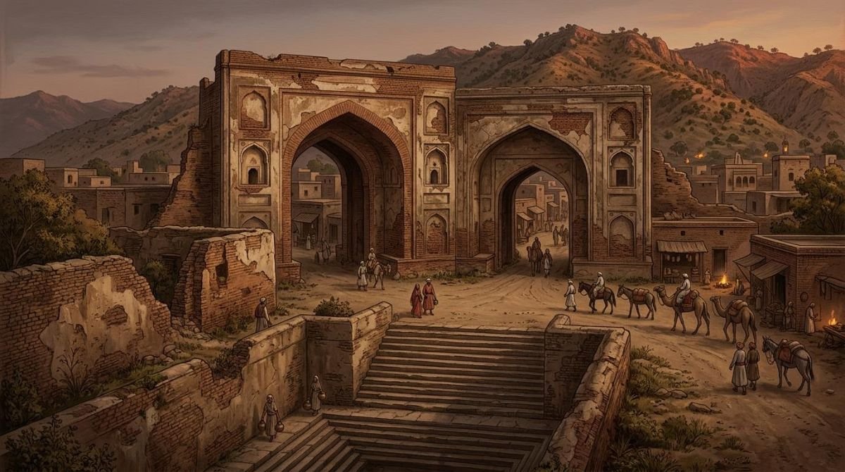
The Bhimber monuments – a Mughal sarai built under Emperor Akbar, a step-well of seventy steps, a royal bath-house, old mosques and the hillside palaces of the Chib rajas – record the two great roles of Bhimber, a town in today’s Azad Jammu and Kashmir just north of the Punjab plains: the “Gate of Kashmir” on the Mughal road from Lahore to Srinagar, and the capital of the Chib Rajputs for some four centuries. This guide follows the survey and photographs in the 1997 Chib history by Raja Muhammad Iftikhar Ali Khan (pp. 36–44, 49–58).
At a glance
- Where
- Bhimber town, District Bhimber, Azad Jammu and Kashmir; about 29 miles north of Gujrat
- Mughal name
- Akbarabad, given by Emperor Akbar; the old name returned after his reign
- Mughal works
- Sarai and Hathi Darwaza, baoli (step-well), hammam, mosques and gardens
- Chib works
- Palace ruins at Bhimber Rajani, still called Mahallan (“the palaces”)
- Chib capital
- From Raja Chib Chand (early 15th century) to Raja Sultan Khan, the last ruler
- Condition (1990s)
- Sarai largely rebuilt as courts and offices; hammam occupied as a house; baoli preserved
- District
- Bhimber became a district again in December 1995
Bhimber, the Gate of Kashmir
For travellers from the Punjab, Bhimber (بھمبر) was where the plains ended and the mountain road to Kashmir began. The book quotes G. M. D. Sufi’s Kashmir, drawing on the Kashmir Archaeology Report: Bhimber is a small town on the right bank of the stream of the same name, which joins the Chenab near Wazirabad, 29 miles north of Gujrat, 23 miles east of Jhelum, 50 miles north-west of Sialkot and 150 miles from Srinagar by the Pir Panjal route. The book credits the French traveller François Bernier with calling it Bab-ul-Kashmir, “the Gate of Kashmir”, and believes the town already bore its name in the time of the Chinese pilgrim Hiuen Tsang, some thirteen hundred years ago. Akbar’s campaign against Kashmir set out from here, and after the conquest he chose this route for the royal road from Lahore to the valley (pp. 37–38, 41).
For about four centuries Bhimber was also the capital of Chibhal, the country of the Chib Rajputs, from the accession of Raja Chib Chand in the early fifteenth century to the fall of Raja Sultan Khan, its last ruler (p. 36). The emperors’ journeys along the road are described in Bhimber: Gateway on the Mughal Road to Kashmir; this article walks through what they and the Chib rajas left behind.
A town on its third site
Thakur Major Singh of Dewa Vatala, whose Tarikh-e-Chibhal (1983 Bikrami, c. 1926) was the first written history of the Chibs, observed that Bhimber “is now settled at a third site” (quoted pp. 42–44):
- Aadhi Dhak. Under Raja Sri Pat, the last Thakial Rajput ruler, whom Chib Chand displaced, the palaces stood at Aadhi Dhak, where the shrine of Baba Shadi Shaheed now is, and the busy town was Jhangar, whose ruins lie two or three miles to the north.
- Bhompur. When the state was divided between the sons of Raja Dharam Chand (Major Singh’s name for Raja Shadab Khan), Raja Bhom Khan took the eastern share and built palaces on a small hill east of the present town, naming the place Bhompur, which Major Singh thought was later worn down into “Bhimber”.
- The present town, which grew up around a Mughal official’s palace and Akbar’s sarai.
Major Singh records two other derivations of the name, from bhandar, a local word for a large sandy stream, and from paigham-bar, “message-bearer”, after barbers who carried messages and lived on the site, but he preferred Bhompur. The Bhimber Nala divided the town. Its eastern (left) bank became Bhimber Rajani, from rajdhani, “capital”, the quarter of Raja Bhom Khan’s line; the western side became Bhimber Rikki, the name under which the present town is still entered in the revenue records. West of the nala lay the lands of Bhom Khan’s brother Raja Mal Khan, the state of Khari Kariali (pp. 38, 43).
Sources differ
The compiler explains “Rikki” as “Rai-ki”, the Bhimber of the Rai: in Chibhal the eldest son took the title Raja and a younger son the title Rai, so the seat of the younger brother, Raja Mal Khan, became “Rai-ki Bhimber” (p. 38). Thakur Major Singh instead derives it from ra’aya, “subjects”: eastern Bhimber was the town of the rajas, western Bhimber that of the commoners (p. 43). The sources also differ slightly on the distance from Gujrat: 29 miles (Sufi) or 28 miles (Major Singh).
Akbarabad and the Mehtas
Major Singh also tells how the Mughal town was born. In Akbar’s reign two Kohli Khatri brothers from Sialkot, Uttam Chand and Parmanand, travelled with Diwan Todar Mal, Akbar’s revenue minister. When the Raja of Bhimber refused to allow a revenue settlement, Todar Mal moved on to Gujrat, but the brothers completed the work, and Akbar rewarded them with revenue-free land, Uttam Chand at Bhimber and Parmanand at Naushera, and the title of Mehta. Uttam Chand built a palace where a few households of commoners lived. Preparing for the conquest of Kashmir, the emperor ordered houses to be built around it, half their cost paid from the royal treasury, with a masonry sarai in the middle, and named the new town Akbarabad. The name did not outlive him. Because the hill journey began here, the emperors broke their journeys at Bhimber for days at a time, which is why it gained hammams and mosques as well (pp. 43–44). The Mehtas’ later rise to power is told in How Bhimber Came Under Jammu.
Major Singh adds a curious find. When Nur Jahan travelled to Kashmir in Jahangir’s time, the hill rajas gathered pine resin for lighting, and the surplus was stored in the sarai or buried. When a wall of the sarai was pulled down in 1956 Bikrami (c. 1899) to rebuild the tehsil offices, hundreds of pitchers were dug up, their pine contents turned as black as lac (p. 44).
The Mughal sarai and the Hathi Darwaza
Built in Akbar’s reign, the sarai stood in the middle of the new town; by Major Singh’s day it lay on the west side, and by the 1990s the town had grown around it again. It was two storeys high and rectangular, with 120 rooms for the troops who guarded the royal caravans. Only ten rooms survive. In place of the rest stand the Sessions Court, the offices of the Deputy Superintendent of Police and the Sub-Divisional Magistrate, and the chambers of the Bhimber Bar; the Sub-Judge’s court sits in a whitewashed arcade of the sarai, and a Mughal mosque is attached to it (pp. 39, 44, 49, 51). The compiler laments that the new buildings have cost Bhimber much of its heritage.
The finest survivor is the Hathi Darwaza, the Elephant Gate, a massive pointed archway which, the book says, had so far escaped “the ravages of time and of our nation” (p. 50). In October 1947 the sarai was fought over again: on 22 October a squad of twenty-five volunteers under Subedar Major Inayat Khan of Barhang was sent against it but was driven back by heavy Dogra fire (pp. 46–47), as told in The Liberation of Bhimber, October 1947.
The baoli, the hammam and the mosques
The baoli of Sattha
About a furlong west of the sarai, in the neighbouring village of Sattha, is the Mughal baoli, a large step-well that supplied the sarai. A long stepped passage between high brick walls leads down past a room in the middle to the water, seventy steps below, and a Mughal inscription is set into it. Until fairly recently the town drew its water from it; a tube-well has since been sunk in it, and it remains well preserved (pp. 39, 54).
The hammam and the Larri wala Khooh
A furlong or so south of the sarai, opposite the Girls’ High School, stands the hammam built for the Mughal army, a low dome over weathered masonry. Underground stairs linked it to a large well beside it, the Larri wala Khooh (“the well with the chain”), and traces of earthen water-pipes remain. By the 1990s it had been allotted to a farmer as a house and was being altered, a loss the compiler mourns at length. Facing it is another domed Mughal building with stairs to its roof, doors on three sides and a few letters of the Kalima on its eastern wall (pp. 39, 52).
Mosques and a lost Mughal garden
On the south-east side of the town, on the Bhimber Nala opposite the recreation park, the creeper-covered mosque of Mohalla Jogi Beg has almost become a ruin, and the Mughal garden beside it has turned into jungle (p. 53). A second old mosque, richly decorated and inscribed, and probably also Mughal, stands in Bhimber Rajani (p. 39).
Bhimber Rajani: palaces of the Chib rajas
On the left bank of the Bhimber Nala, north of the present town, Raja Bhom Khan, eldest son of Raja Shadab Khan (Baba Shadi Shaheed), built his palaces, a hall of public audience (Diwan-e-Am) and other buildings. According to Major Singh, every Muslim raja from Bhom Khan to Raja Sultan Khan lived here: “In those days there was great splendour there; now only ruins remain, and one mosque stands” (pp. 38, 43). Beside the mosque are the remains of the palaces of Raja Sultan Khan, and the site is still called Mahallan, “the palaces”, in the revenue records (p. 39). The book’s photograph shows only a stony, scrub-covered hillside and a bare tree, captioned with a couplet in which the ruins address the traveller:
Look at me, if you have eyes that heed a warning; listen to me, if you have ears that take advice.
— Couplet quoted in the caption on p. 55; the book does not name the poet, but the lines are generally attributed to Mirza Ghalib
Two smaller monuments survive at Mahallan: a small domed tomb with a ribbed arch, perhaps, the book suggests, the grave of a great man or a member of the royal family (p. 57), and the whitewashed baithak (sitting-place) of Hazrat Panj Pir, described in our guide to the shrines of Bhimber (p. 58).
Monuments around Bhimber
In the Samahni valley to the north the compiler saw remains that he assigned to the age of the Kauravas and Pandavas. Between Samahni and Bandala stand two old temples of huge black stones on large platforms, called Dhere by the people of Samahni, who believe giants and fairies built them; carved images survive inside, and nearby are traces of the Pariyon ka Talla, the “Fairies’ Pond”, with stone channels running to wells capped by great rocks. Ploughmen between Bandala and Samahni have turned up bronze vessels and old coins whose designs the book likens to those of ancient Egypt, and near Manawar on the Tawi the “Dau Wala Talab” resembles the Samahni tank (pp. 38–39).
Beside Bandala stands the Sarai of Sa’dabad, named after Sa’d Khan, Shah Jahan’s superintendent of buildings: rectangular, with great gates on the east and west, a small mosque, a walled garden and an old rest house. Nearby were the quarters of the Mughal Begums, for whom a bridge was built and the stream dammed into a lake, and on a high hill to the south-east stand the fort and town of Bagh Sar (p. 40). Beyond Sa’dabad the old road passes into Indian-administered Kashmir, towards Naushera, which had its own Mughal sarai and belonged to Bhimber tehsil before 1947, and the Hathi Nala, where a stone-carver cut two elephants into the rocks so lifelike that, it is said, the Mughals’ own elephants shied at them.
Of the tehsil’s pre-1947 forts, Manawar, Khamba, Naushera and Padhar, only the ruins of Manawar and Padhar remain, the book says, while Khamba and Naushera lie in Indian-administered Kashmir; the Ibrat Nama adds Fort Kangri, Mangla Devi and Dharal to the strongholds of the Bhimber Raj, so steep that they could be climbed only by ladder (pp. 40–41). Nearer the town, the Sukka Talab, a tank of 1937 Bikrami (c. 1880), is described with the shrines. The book also traces Bhimber’s changing status: Manawar was the district headquarters in 1928 Bikrami (c. 1871), Bhimber became a district in 1944 Bikrami (c. 1887), Mirpur replaced it in 1956 Bikrami (c. 1899), and Bhimber became a district again in December 1995. The town rebuilt after 1947 then had boys’ and girls’ schools and degree colleges, a civil hospital and a Combined Military Hospital, banks, a telephone exchange and its district courts (pp. 41, 47).
Bhimber monuments at a glance
| Monument | Where | What the book records |
|---|---|---|
| Mughal sarai | Heart of Bhimber town | Built under Akbar; two storeys, rectangular, 120 rooms for caravan guards; 10 rooms survive, courts and offices built over the rest (pp. 44, 49, 51) |
| Hathi Darwaza | In the Mughal sarai | Elephant Gate with a high pointed arch; still standing (p. 50) |
| Baoli (step-well) | About a furlong west of the sarai, in Sattha | Seventy steps to the water, a room in the middle, a Mughal inscription; preserved, with a tube-well (pp. 39, 54) |
| Hammam | South of the sarai, opposite the Girls’ High School | Bath-house of the Mughal army, linked by underground stairs to the Larri wala Khooh; occupied as a house (pp. 39, 52) |
| Jogi Beg mosque | South-east side, on the Bhimber Nala | Mughal-era mosque and garden; nearly ruined (p. 53) |
| Mahallan | Bhimber Rajani, north of the town | Ruined palaces of Raja Bhom Khan’s line and of Raja Sultan Khan; an old mosque and a domed tomb (pp. 38–39, 55, 57) |
| Sarai Sa’dabad | Beside Bandala, Samahni valley | Named after Sa’d Khan, Shah Jahan’s superintendent of buildings; mosque, walled garden, rest house (p. 40) |
Frequently asked questions
What are the main monuments of Bhimber?
The 1997 Chib history lists a Mughal sarai with its Hathi Darwaza (Elephant Gate), a seventy-step baoli or step-well, a Mughal hammam and well, several old mosques, and the ruined palaces of the Chib rajas at Bhimber Rajani, known as Mahallan. Nearby are the Sarai of Sa’dabad, Bagh Sar fort and the Sukka Talab.
Who built the Mughal sarai at Bhimber?
It was built in the reign of Emperor Akbar. Thakur Major Singh relates that Akbar ordered a masonry sarai in the middle of a new town called Akbarabad. It had 120 rooms for the troops guarding royal caravans; by the 1990s only ten survived, the rest having been replaced by courts and offices.
What is Bhimber Rajani?
Bhimber Rajani, from rajdhani or capital, is the old royal quarter on the left bank of the Bhimber Nala, north of the present town. Raja Bhom Khan and his successors down to Raja Sultan Khan built their palaces there, and the ruins are still called Mahallan, the palaces, in revenue records.
Why was Bhimber called Akbarabad?
According to Thakur Major Singh, Akbar, preparing to conquer Kashmir, ordered a new town and sarai to be built at Bhimber, paying half the cost of each house from the royal treasury, and named it Akbarabad. After Akbar’s reign the old name Bhimber came back into use.
Where does the name Bhimber come from?
Thakur Major Singh gives three explanations: from Bhompur, the palace town of Raja Bhom Khan; from bhandar, a local word for a large sandy stream; or from paigham-bar, message-bearers. He preferred the first. The book also holds that the town already bore this name in the time of the Chinese pilgrim Hiuen Tsang.
Sources
- Raja Muhammad Iftikhar Ali Khan, Raja Shadab Khan alias Hazrat Baba Shadi Shaheed (Urdu, Barhang/Karachi, 1997), pp. 36–47, 49–58.
- Thakur Major Singh of Dewa Vatala, Tarikh-e-Chibhal (1983 Bikrami, c. 1926), pp. 61–64, as quoted in the book.
- G. M. D. Sufi, Kashmir, citing the Kashmir Archaeology Report, as quoted in the book.
- Ibrat Nama and Ganesh Das Wadhera, Char Bagh-e-Punjab, as quoted in the book.
This article is part of our series based on the 1997 Chib history; see the book, chapter by chapter. Spellings of names follow the book.
